Search

Historic Evansville

The definitive site for all things historic in Evansville

Sanborn Maps


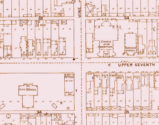
Close up view near 7th and Vine
1895 Sanborn Map - Sheet 21
HistoricEvansville.com now has interactive Sanborn maps! These maps were maps created by the Sanborn Company to help determine risk and rates for fire insurance. Incidentally, they provide a significant amount of detail for historians at the street level, including building outlines, address numbers and building use. They were only done for certain larger towns and during various years, so it's a gamble if and when they were completed. Evansville had four major ones, listed below. Click on a year to see the map. You may have to scroll a lot, but the detail is well worth the effort!

1884

1884 - immediate vicinity, Evansville city limits only

1895

1895 - much expanded, espeically north

1910

1910 Vol I - west of Main St
1910 Vol II - east of Main St
1918 and 1923 updates - city growth northeast and east

1962

1962 Vol I - west of Main St
1962 Vol II - southeast of Main St and Division
1962 Vol III - northeast of Main St and Division and points farther east


Return to maps home