Historic Evansville
The definitive site for all things historic in Evansville
Wabash & Erie Canal
Beginnings as the Central Canal
Canals were the interstate transportation systems of the early 19th century. The success of the Erie Canal, connecting the Hudson River in New York City to the Great Lakes, encouraged canal construction. A land grant in 1827 started the Wabash & Erie Canal, and with its progress additional land grants spurred a rash of canal-building. A race to create a route of transportation for goods from the East Coast was on.
In 1834, it was announced that the Central Canal would be built connecting Wabash River to the Ohio River, starting in Peru, continuing through Indianapolis, and terminating in Evansville. Following this announcement, the town experienced a resurgence of growth.
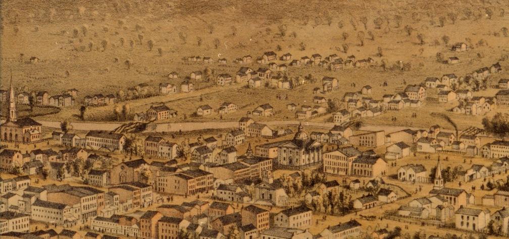
The W & E Canal passing through Evansville.
Construction on the Central Canal began in Evansville in 1836. Roughly 20 miles of the canal had been completed north by 1839, extending from 5th St to the Pigeon Creek dam near the Gibson County line.
Despite a promising start, a financial crisis in the 1840s put a halt to most of the canal projects, and the Central Canal sat uncompleted.
A project revitalized
In 1845 another land grant was established to complete the Wabash & Erie Canal. The Central and Cross-Cut Canals were joined into the Wabash & Erie, and a new route extending the canal all the way to the Ohio River was laid out in 1846. The Cross-Cut Canal (another abandoned canal project) connected from Terre Haute to Worthington. From Worthington, the canal headed south following the old proposed Central Canal route. Just as before, news of the canal bolstered Evansville. The city was granted its charter in 1847, and a wharf was built in 1848 to handle the transfer of goods from the canal to boat traffic. Small communities along the Wabash & Erie Canal, such as the town of Smyrna, were also established in the hopes the canal would help them flourish.
Construction resumed on the Wabash & Erie Canal, and it connected to Terre Haute in 1849. The abandoned Cross Cut Canal was completed by 1850, and the portion from Worthington south to Evansville was finished in 1853. Approximately 460 miles long, the canal became the nation's longest, connecting Lake Erie (at Toledo, Ohio) with the Ohio River. Just as it did Evansville, the Wabash & Erie Canal helped grow several Indiana cities along its towpath, including Fort Wayne, Lafayette, and Terre Haute. More locally it passed through towns like Francisco and Petersburg.
When the canal was completed in 1853, water was let into its ditch and it became operational. The "Pennsylvania" was the first boat to make the entire trip from Lake Erie to Evansville and arrived September 22, 1853. The canal in Evansville included a basin used for turning boats for return trips and docking facilities for loading and unloading passengers and cargo. As a byproduct, the canal was a major source of water power during the 1850s, and several businesses were built along its route.
In Evansville, the canal entered along the Southern RR parallel to State Road 62. It headed into town through the Wesselmen Park woods and continued to Canal St. The canal turned northwest at 5th St, though land was allocated for a spur continuing to 2nd St (uncertain if it was proposed or built). It jogged near Vine St to a basin on the old Courthouse block. The canal continued on what is now 4th St, and it crossed 3rd St Lamasco (Ohio St) and 4th St Lamasco (Pennsylvania St). The canal then turned west along (Indiana St) and finally ended in a basin at the corner of Seventh Ave and Canal St (Indiana). A good view of the canal can be viewed in the 1852 Evansville and Lamasco City map.
.jpg)
To ease accessability bridges were built over the canal on several downtown streets. The canal company agreed to build the bridges provided the city maintained them.
Bridges over Canal in town
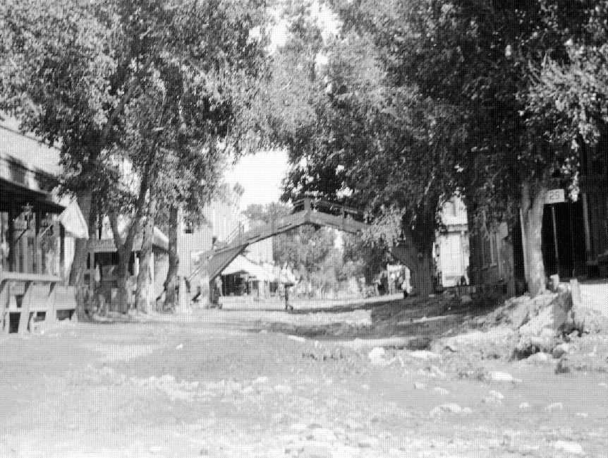
Possibly an old bridge from the W & E Canal (after canal was filled in)
| Street |
|---|
| Boonville Rd (Lincoln Ave) at Canal St |
| 9th St (1861) |
| 8th St* |
| 6th?* |
| Chestnut St |
| Walnut St |
| Locust St* |
| Main St* |
| Sycamore St* |
| Vine St* |
| Division St (Court St) |
| Ingle St* |
| Market St/ Second Ave* |
| Third Ave |
| Fulton Ave* |
A short-lived venture
Despite efforts to make the Wabash & Erie Canal work, the project was impractical from the onset. Its limited use (the canal was disabled by freezing temperatures, drought, or flooding) couldn't compete with the reliability of the railroad. Additionally, the fear that stagnant water might bring disease made the canal unpopular with Evansville citizens. By 1860, most of the southern section was no longer used, and the entire Wabash & Erie Canal from Terre Haute was abandoned in 1861. The following year, the canal bridges within the city were replaced with box culverts with fill dirt over them in 1862. This allowed access to canal waters for those businesses still needing water power for their day-to-day operations. The canal bed was filled in entirely in 1870. Several streets comprised of the old canal bed were named Canal St, explaining the multiple "Canal Streets" found in old maps and street listings.
In 1876, the property of the Wabash & Erie Canal was sold at auction 1876. Several land owners filed suit against the government, however, stating that once the canal failed its property should be returned to them. Legal battles went on for years.
The flat towpath of the canal was suitable for railroad development, and a section of the old W & E canal was used for the Lake Erie, Evansville & South Western (L E E & S W) RR c1871. This line was later part of the Louisville, Evansville, & St. Louis (L E & St L) RR and later still part of the Southern RR. The old canal and tracks can still be seen along Morgan Ave near Wesselmen Park and Stockwell Rd.
Once the canal was abandoned, Smyrna, as with several other tiny communities in Warrick County (Warrickton, Newark, Millersburgh, Boston, Dongola), failed to grow and faded away. Today few remnants of the old W & E Canal can still be seen, but it left an indelible mark in Evansville's history. View a map of Wabash & Erie Canal along with the other railroad routes.