Historic Evansville
The definitive site for all things historic in Evansville
Matching Tags: Holy Trinity Catholic Church [holytrinity]
.jpg) Holy Trinity Catholic Church | 1856 Map of Evansville |  1880 Map of Evansville |
 1888 Map of Evansville | .jpg) Courthouse (1909) |  City Jail |
 City Jail | .jpg) Sheriff's Residence | .jpg) Old Post Office and Custom House being built |
.jpg) Old Post Office under renovation | .jpg) Casino Bar |  Manufacturers' Association Building |
 Aerial shot of Holy Trinity | .jpg) Holy Trinity Sister's Home |  Ruins left in wake of church fire |
 Waders |  Tower crashes |  Memories |
 In the wake of the flames |  Ruins left in wake of church fire | .jpg) Holy Trinity parish house nears completion |
 Trinity Catholic School and Church |  Trinity (Catholic) Church and School | .jpg) Holy Trinity rectory |
.jpg) Side of Holy Trinity School |  Holy Trinity School | .jpg) Holy Trinity church and school |
.jpg) Holy Trinity Catholic | .jpg) Trinity Catholic Church & School |  Holy Trinity |
 Holy Trinity |  Holy Trinity | .jpg) Second St at Carpenter Street |
 Court House, Catholich Trinity, German ME Churches, Sheriff's Residence and Jail |  General Cigar Co | .jpg) Side of Holy Trinity Rectory |
.jpg) Heilman Plow Co | .jpg) Fellwock Garage 1923 | .jpg) General Cigar Building |
.jpg) Parish offices of Holy Trinity |  Interior of Holy Trinity | .jpg) The home of the Courier 1940s |
.jpg) Holy Trinity School 1958 | .jpg) Side of Holy Trinity school just before demolition | .jpg) Trinity (Catholic) |
.jpg) 3rd St near Walnut 1946 | .jpg) Construction of Greyhound Station | .jpg) School boys atop carport |
.jpg) Holy Trinity parish school and temporary Catholic high school | .jpg) Boys on fire escape at Catholic High School |  Holy Trinity Church |
.jpg) Holy Trinity c1851 | .jpg) Holy Trinity | .jpg) Holy Trinity Catholic School |
.jpg) Evansville Press | .jpg) Modern building of the Evansville Press |  2.jpg) New home of the Evansville Press |
 3.jpg) The newest Press structure | .jpg) Holy Trinity Rectory nearing completion |  1884 Sanborn Map |
 1895 Sanborn Map |  1910 Sanborn Map | .jpg) Downtown during 1937 Flood |
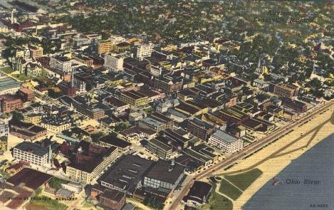
.jpg) Downtown 1946 |  Aerial view of downtown and Ohio River | .jpg) 4th St c1930 |
.jpg) Panoramic of Downtown (c1935) | .jpg) 1901 courthouse view looking southwest | .jpg) View from Courthouse |
 View from Post Office |  Bird's Eye View from Post Office |  View of Evansville from Post Office |
.jpg) Downtown panoramic (c1907) |  Bird's Eye View | .jpg) Evansville on the Ohio 1872 |
.jpg) Evansville c1856 | .jpg) Lower Downtown 1919 | .jpg) Bird's eye view from Water Works |
 Panoramic view of Riverside Dr, northwest | .jpg) Downtown 1923 | .jpg) Downtown along Vine St late 1880s |
.jpg) Downtown 1940 | .jpg) Downtown Evansville 1937 | .jpg) Future location of Lloyd Expressway |