Historic Evansville
The definitive site for all things historic in Evansville
Forest Hills
AKA: Coal Mine Hill, Reitz Hill
Just west of Evansville stands a large hill with scenic views of the river city. It was initially known as Coal Mine Hill because of the mining done by Ingle Coal at the foot of the hill near the river. It sat largely undeveloped until the early 1900s when the hillside was tapped as a prime residential area.
Forest Hills (sometimes spelled Forrest Hills) was officially platted in 1910. The developers maximized the hilly terrain while emphasizing saving trees to keep the forest-like setting. Houses started popping up within a year, and other additions saw the bulk of development in the 1910s and 1920s, which is why bungalows are the prominent style. Some of the platted roads were never fully built, and several of the roads were later renamed.
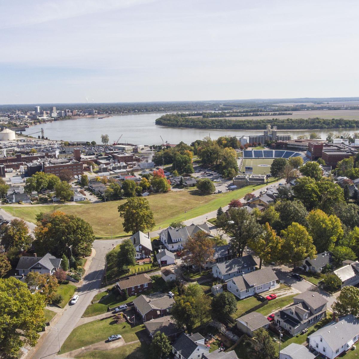
Reitz High School, built in 1918, was the jewel of the neighborhood, and its original entrance towered over the city with incredible views. It's no mistake that the bowl was also built to work with the terrain. In 1921 the back side of the hill was developed into Reitz's football stadium. The school's address for a long time was simply "Forest Hills." There are also two churches that carry the Forest Hills name (Forest Hills Baptist and Forest Hills Wesleyan). Now more commonly referred to as Reitz Hill, the neighborhood retains a strong sense of identity especially on football game nights every fall.
Forest Hills was promptly annexed into the city 1915 while development was still occurring. The Reitz Hill Neighborhood Association is defined by the boundaries Barker Ave, Pennsylvania St, Claremont Ave and Lemcke.
View the map of the Forest Hills district
| Original Forest Hills Name | Current Street Name | Notes |
| Pennsylvania St | [same] | North side of road removed, now functions as onramp for eastbound traffic |
| Sonntag Ave | North segment of Forest | |
| Forest Ave | [same] | |
| Richardt Blvd | Hillcrest Ter | |
| Marion Ave | [same] | originally angled line up with Short Marion |
| Short Marion Ave | used to connect to Dreier | |
| Park Ln | ||
| Oak Dr | Sonntag Ave | |
| Reis Ave | lower part of bowl, never developed / forest | |
| Dreier Blvd | [same] | |
| McDowell Ave | Marine Ave / Rick Davis Way | renamed after local politician died c2020 |
| Decker | Claremont Ave | |
| Hartmetz Ave | [same] | |
| Austin Ave | [same] | |
| Edgewood Dr | [same] |
Research Notes
+ Show research notes